DISCOVER MERSCH AND ITS INTERESTING HISTORY
To give you an impression of what our beautiful commune Mersch has to offer, watch this film:
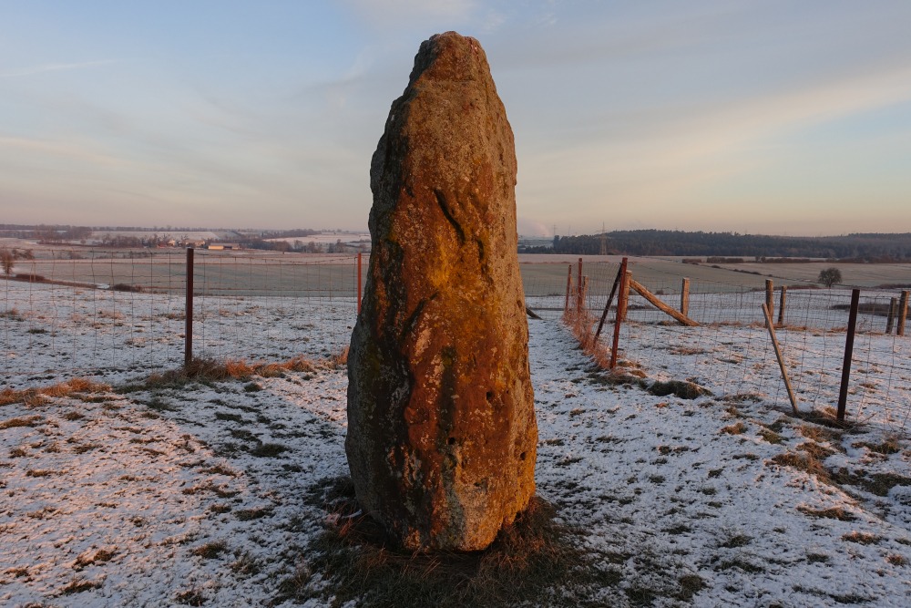
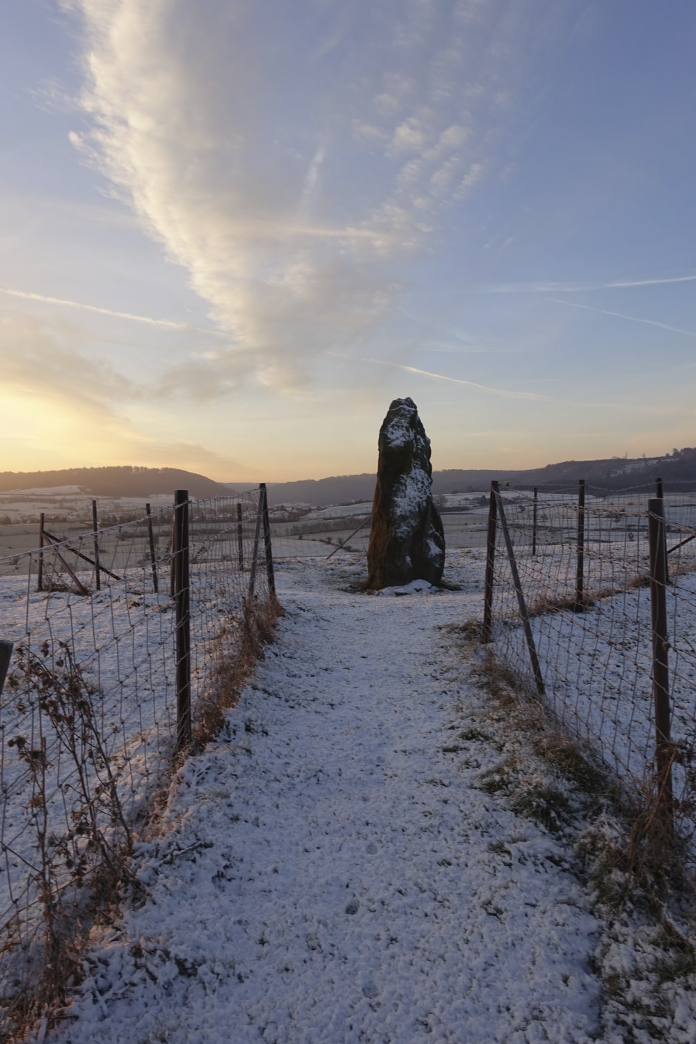
MENHIR
The „Menhir“ situated on the „Béisebierg“, near Reckange is the oldest memorial stone created by human being, in Luxembourg. This memorial stone originates from the earlier stone age (4500 years old). The “Menhir”, also called “Hinkelstone” is created with sand stone, is 3 meters high and weighs 4 tons. Over the years, the “Menhir” had fallen over, but in 1978 it has been re-constructed by three members of the “Friends of old Mersch”. Since 2017, this memorial stone has been classified as a National Monument.
EENELTER
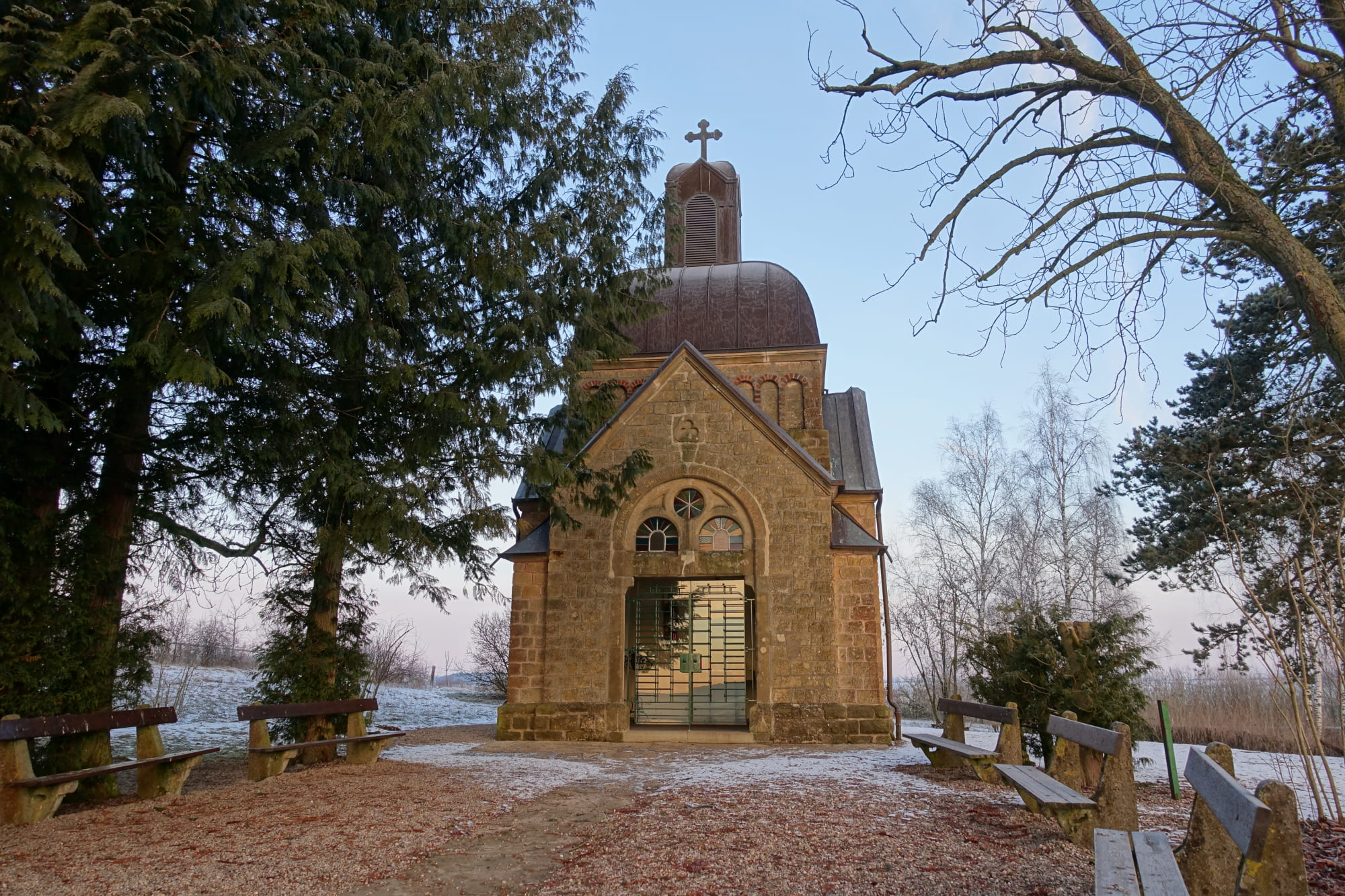
Eenelter or Elenter is a pilgrim place, where around 1050 A.D: Theobald von Provins has settled himself together with a friend. Three years later they both moved on to Santiago de Compostella. During the Middle Ages, a prosperous market developed around the small chapel. The chapel was destroyed several times, but has been rebuilt.
1896/97 the current chapel was built, in honour of the holy Donatus and the holy Theobald.
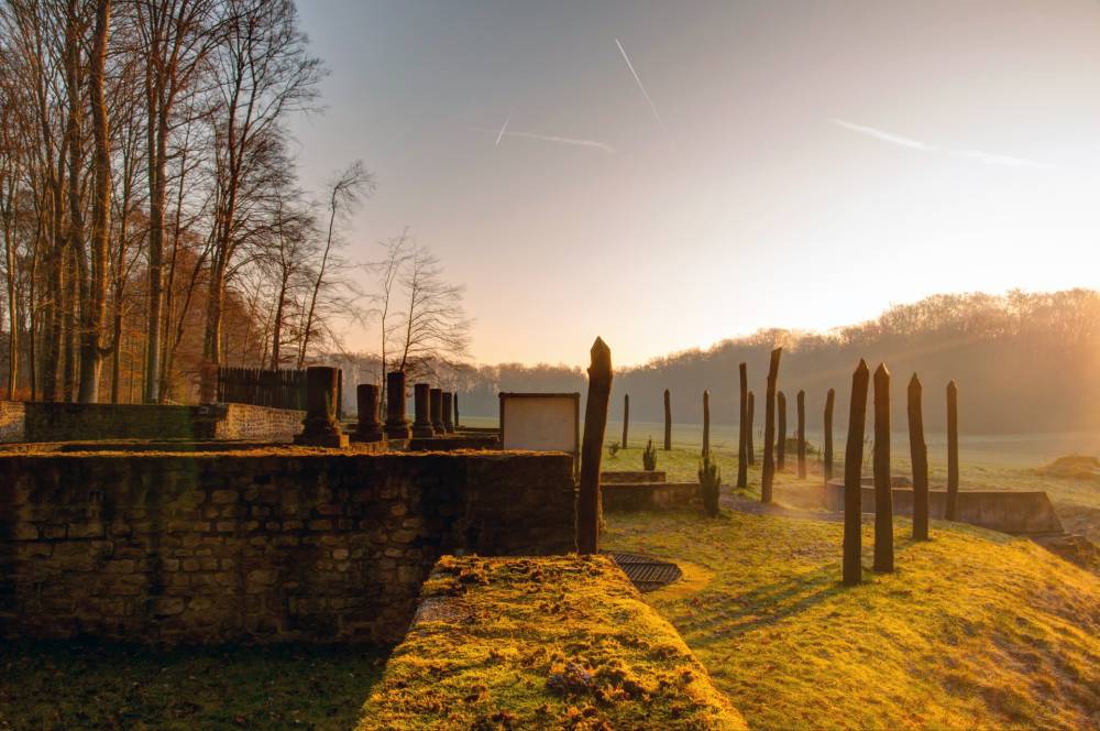
ROMAN PALACE
1905/06 a part of this palace has been excavated under the direction of architect C. Arendt. In order to protect a well conserved part of the warm air heating system (Hypokaust) for the next generation, a protecting cover has been constructed above it.
When, in 1966 this field “op de Mies” got classified as arable land, the archaeologists were able to justify, that this palace had a volume of 200 x 60 meter and that in front of this palace existed a ceremonious basin, with a surface of 75,6 x 6,5 meters.
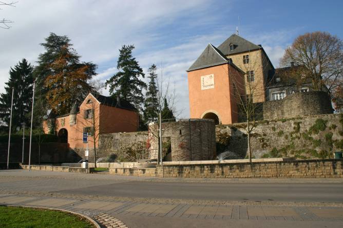
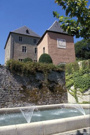
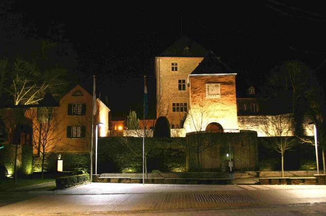
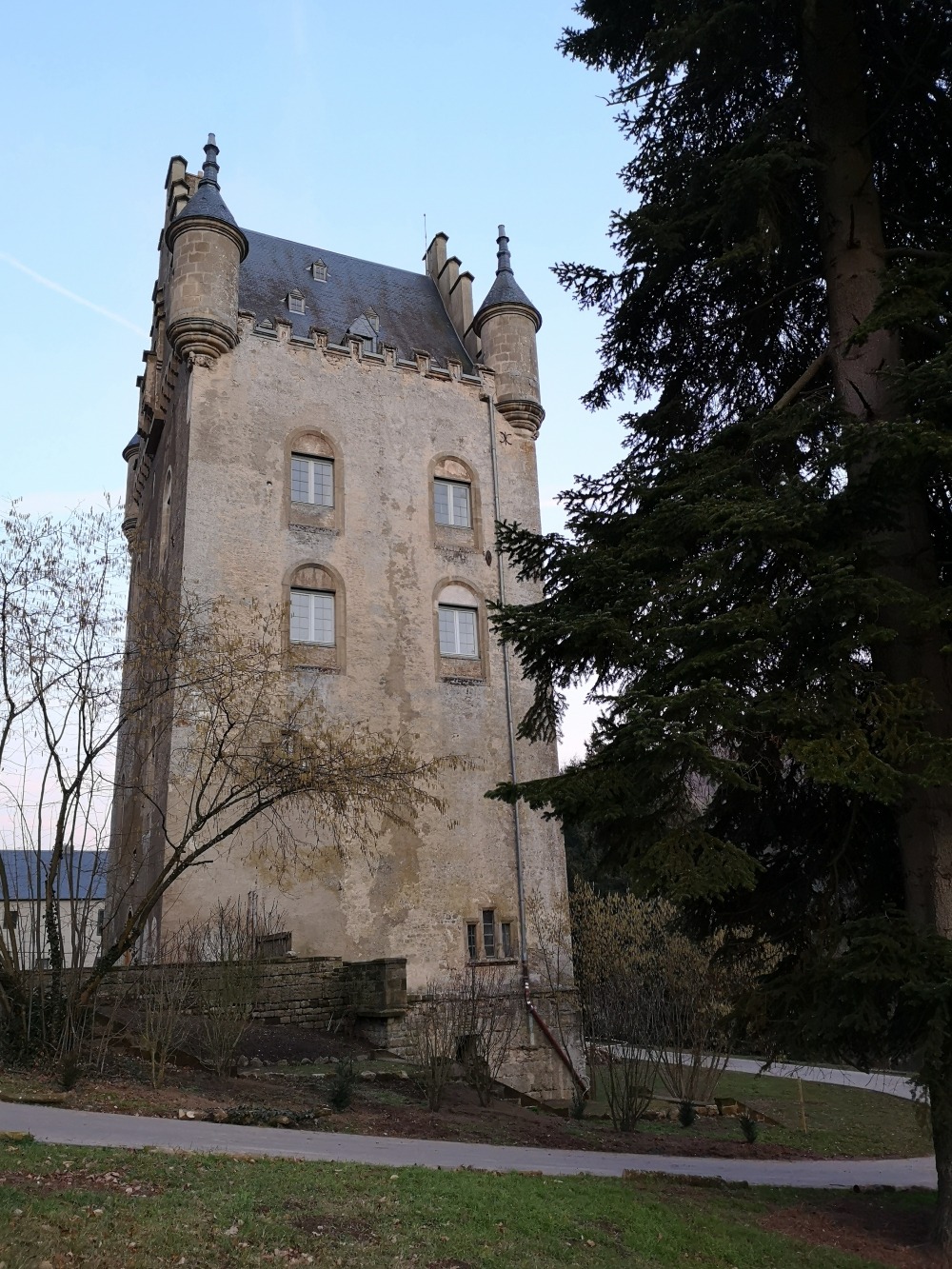
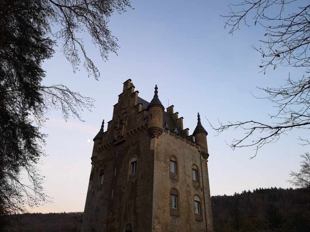
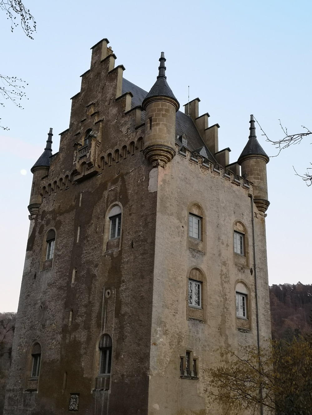
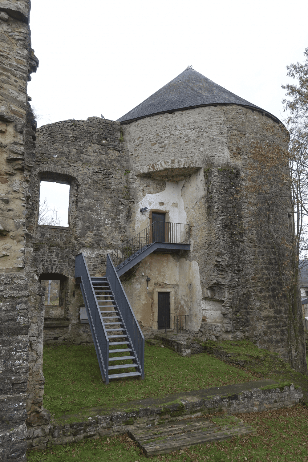
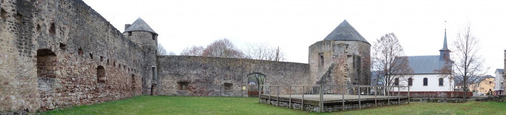
CASTLE OF MERSCH
In 1232 Theodorich L bought a property in Mersch, in the purchase-agreement a “turris” is described. This tower is a “Bergfried”, with a square map of 12 meters of length. During a later construction stage, the Bergfried is extended towards the north-west, this we could concede with the following up of the rows of stones. At the end of the 16th century Paul von der Fels and his wife Apollonia von Kerpen rebuilt this fortified building into a castle with a front part in Renaissance style. This castle is now owned by the Community and is now the Town Hall.
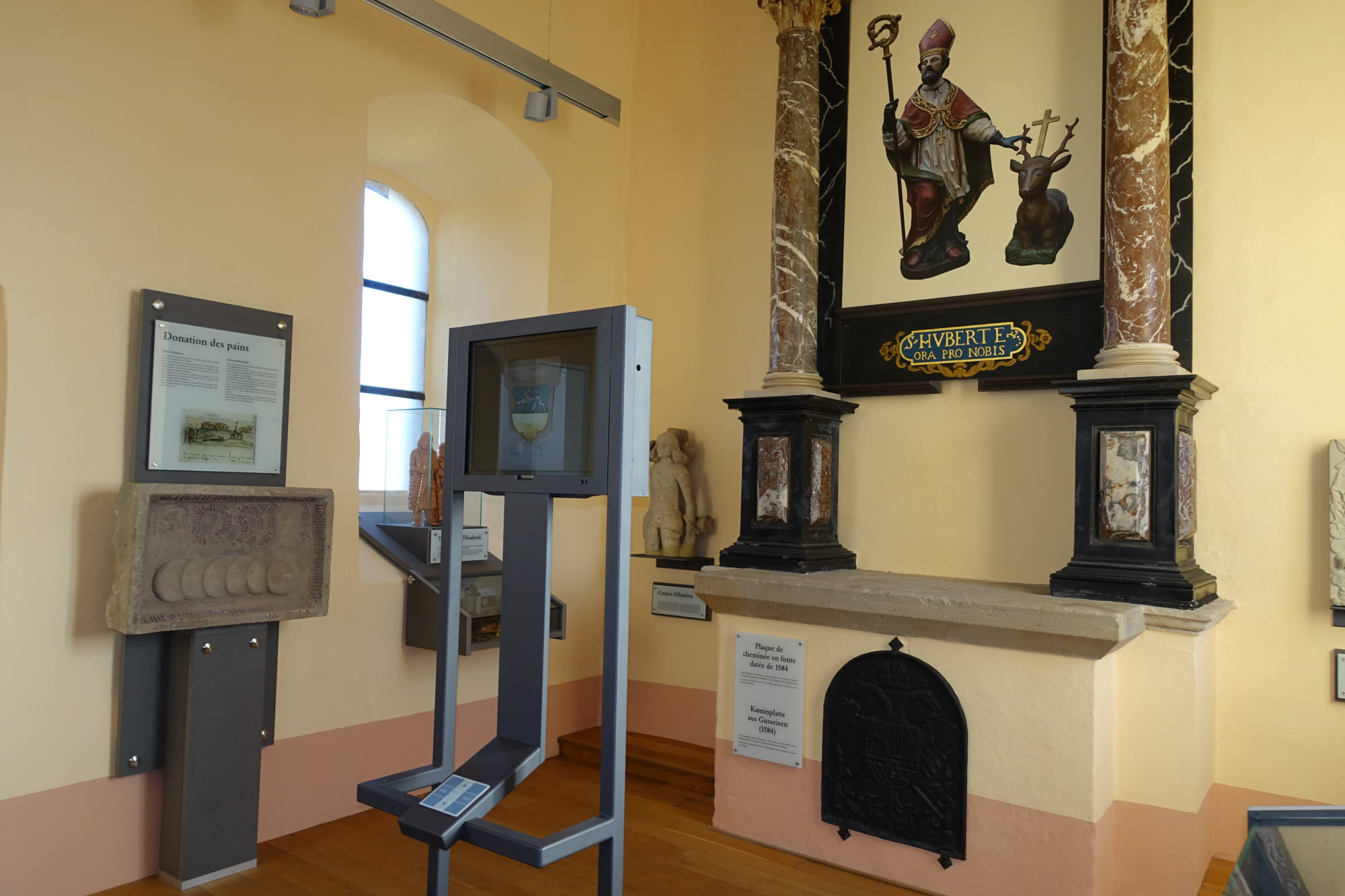
THE MUSEUM IN THE CHAPEL OF THE CASTLE
The castle chapel has been inaugurated in 1717. The altar dates from this time and was dedicated to Saint Hubertus. Above the altar we can recognise the marital weapon of the families von Fels and von Elter. The tomb of Fock von Hübingen got a place in the museum, as well as the charity plate from the 14th century. The statue of st. Sebastiaan comes from the former Deanery church. The history of the castle is explained on an information column.
THE CASTLE OF SCHOENFELS
With a hight of 21 meters, a length of 17 meters and a width of 13 meters, the former tower is the most impressive residential tower of Luxembourg. 1292 the name of Ferri von Schönfesl was mentioned. At the entrance, you can find the weapon of the family Schliedere (Schloeder) von Lachen.
During the 19th century, the outside of the building got changed in the neo gothic style; the roof constructions were added and the windows were constructed taller. Since 1971, the owner of the castle is the Luxembourgish Government.
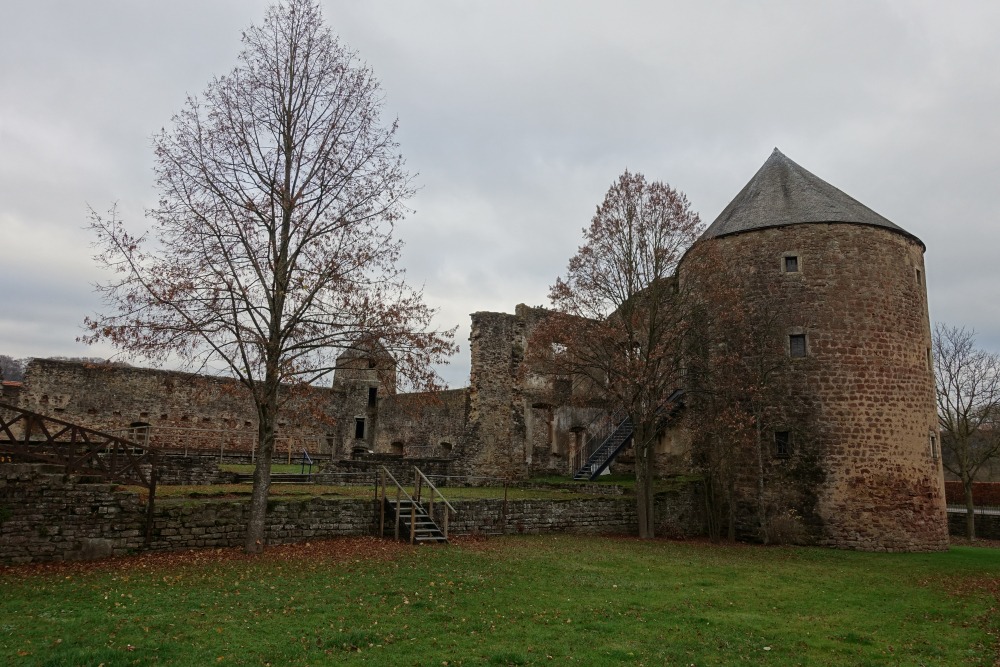
THE CASTLE OF PETTINGEN
Pettingen is one of the best conserved water castles of the country. The square place of each 30m was surrounded by a water ditch of 15 meters. In 1244 Arnould von Pittingen as vassal of Gravin Ermesinde, signed the freedom charter of the city of Luxembourg, Johan der Blinde granted the family von Pittingen the jurisdiction of the supervision van Pittingen.
The fortified building was destroyed in the15th century and rebuilt as a castle in the beginning of the 16th century. The 9×9 meters large tower reminds us of the earlier stronghold of the Lords of Pittingen.
1947 the castle was bought by the Luxembourgish government, for the symbolic amount of 1 Frank.
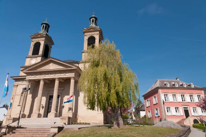
THE PARISH CHURCH OF MERSCH
After the church at the Michel’s Square had fallen into decay, the actual church with its 3 ships was built from 1844 – 1850 in the classicism style. As example they took the church of Stenay (France).
The house front, carried by for pillars, has a topography with the eye of the divine omniscience. In the side aisles, you can see massive statues of the disciples Petrus and Paulus.
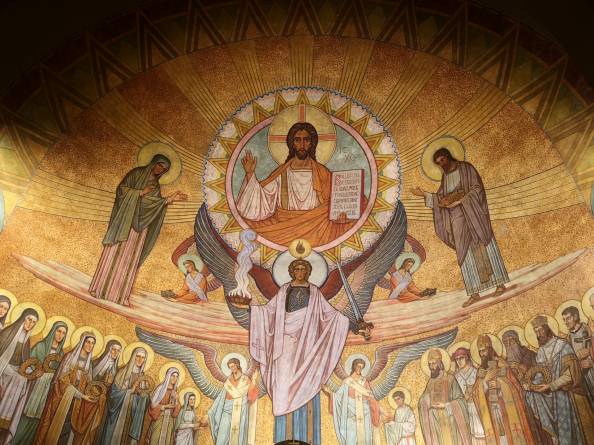
In the thirties of the 20th century the interior of the church was embellished with magnificent paintings, by monk Notker Becker of the Benedikts Abbey of Maria Laach.
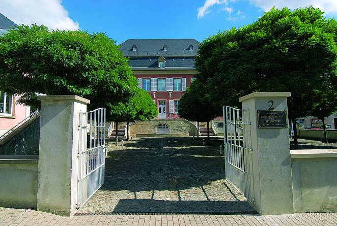
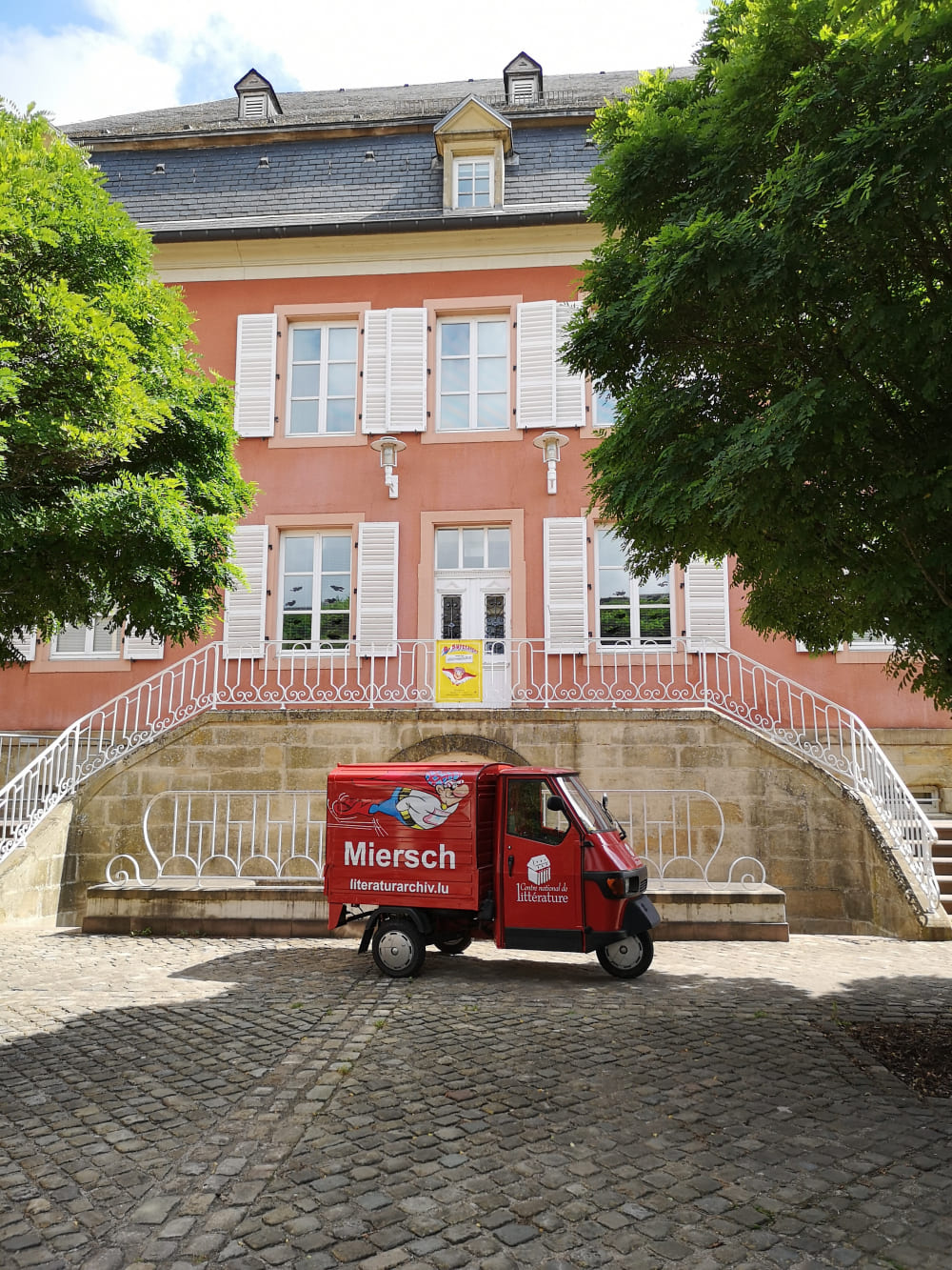
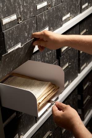
SERVAIS HOUSE
Since 1995, “the National Center of Literature“is situated in the Servais House.
The house was built in 1788 by Philippe Servais in the Udingen-lez-Mersch district. His son, Emmanuel Servais, was Minister of State, President of the Council of State, President of the Chamber of Deputies and Mayor of Luxembourg City. Jeanne Servais bequeathed the Maison Servais to the Commune with the stipulation that the gardens be converted into a public park and the house, at least in part, into a museum.
In 1988, an exchange transaction between the Municipality of Mersch and the Luxembourgish government takes place; the Municipality receives the Castle in Mersch and the Government takes over the Servais house.
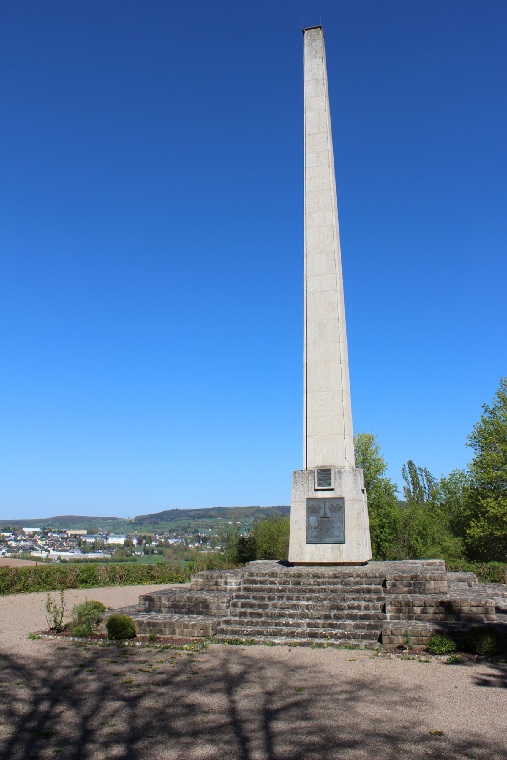
THE KROUNEBIERG
In 1939 Luxembourg celebrates with huge enthusiasm their 100-year independence. On the initiative of the city council a Monument will be built as a credence for the patriotic attitude of the population. Spontaneous donations assured the necessary amount and the Monument was created according to the concept of Henri Luja. Four weapon shields, forged I bronze, as well as an inscription from Nik Welter decorate the support. This Monument was never inaugurated, because in September 1939 the 2nd World war started. By order of the Commander Gustaf Simon this Monument was demolished. The still existing pillar stump is a reminder of the former monument.
After the war, the Mersch town council decided to erect a new monument. This new monument, this time by Paul Luja, commemorates our independence and the horrors of the Second World War.
MÉCHELSPLAZ- MARKET PLACE
In 1851, the former church which had fallen into decay, was demolished and, as a result, a marketplace where village life could take place, came into being in the middle of Mersch.
Since the 8th century B. C., there are traces of settlements on the Michels place. In 3rd -5th century A.D., a church existed in a former Roman building. Later we have e mixed church building.In 853 a church was mentioned in the last will of Erkanfrida, this church was sacrificed to the Saint Michael.
In the 11th century a Romain Church was built, which, in the 15th century A.D., was converted in the Gothic style.
In 1851 at the destruction of that church, coins and sarcophaguses from the Frankish time as well as a partially conserved inscription of a high Roman officer were found on the spot.
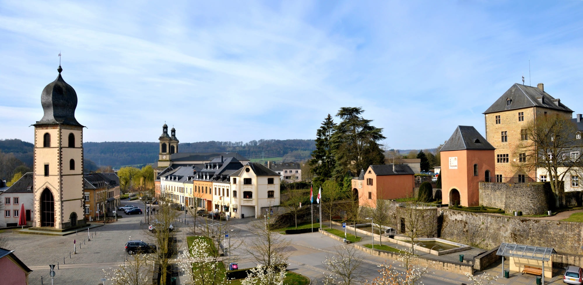
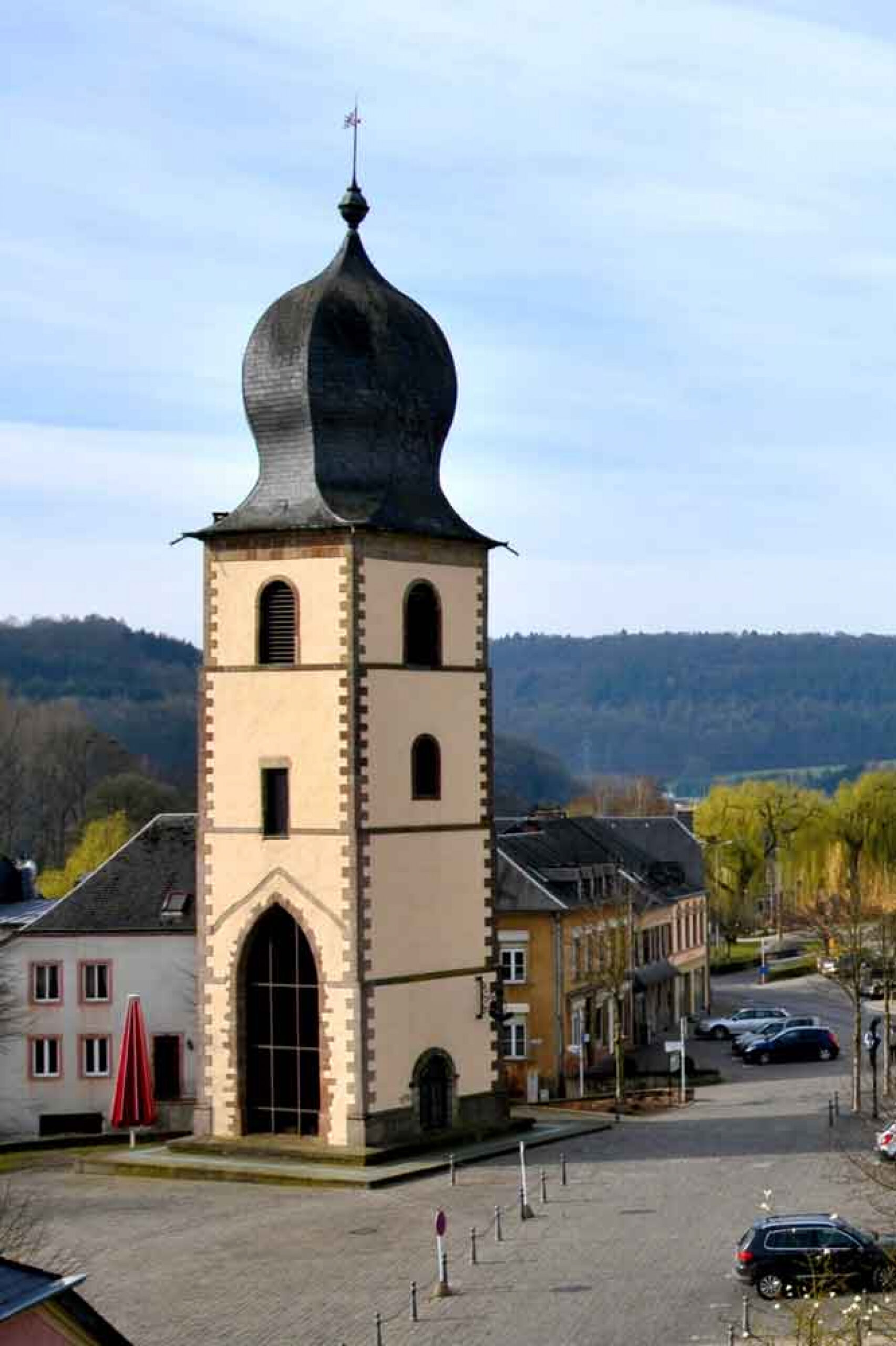
THE MICHAEL’S TOWER
The “Old Tower” from 1709, together with the statue of the Dragon Killer, Saint Michael, is a Landmark/Symbol on the Marketplace of Mersch. Above the entrance we find the weapon of Count von Elter, earlier Master of Mersch, who ordered the construction.
This 35 meters high Tower was built with the money of the parish “DENARIO PAOCHCHIAE FACTA CUM”.
During a thunderstorm, in 1706 the lightning had caused a terrible fire. The church was again restored, but the tower had to be rebuilt.
The existing of the Tower is thanks to queen Anna Palowna, wife of Wilhelm II, King of the Netherlands and Grand Duc of Luxembourg. During a visit in Mersch, she asked the city council, not to demolish the Tower, because this onion tower reminded her on the churches in her homeland Russia.
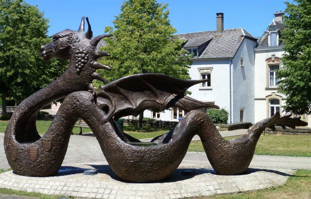
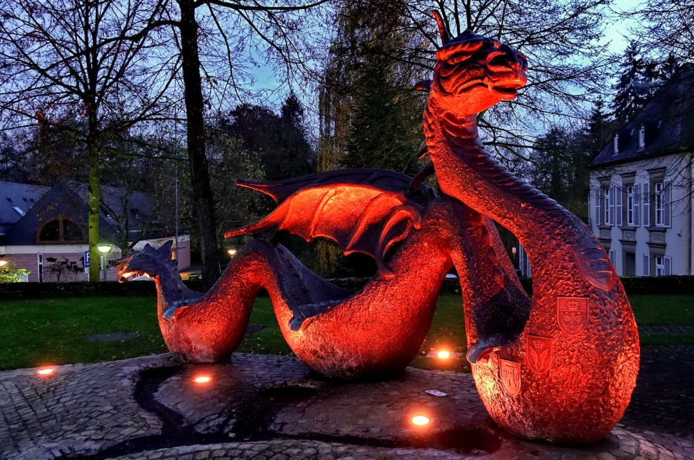
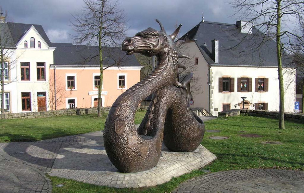
THE DRAGON
When the market square was renovated in 1997, the tower was given a new companion: a dragon created by sculptor and Mersch resident Paul Eyschen.
The 3 water-basins personify the rivers Alzette, Mamer and Eich. The 11 Weapons remind us that Mersch is the capital of the canton. The 7 bumps represent the 7 Castles in the Valley of Mersch. At the head of the dragon, we can recognise the grapes, brought by the Romains to Mersch; the floor name “am Wangert” (vineyard) reminds us of that.
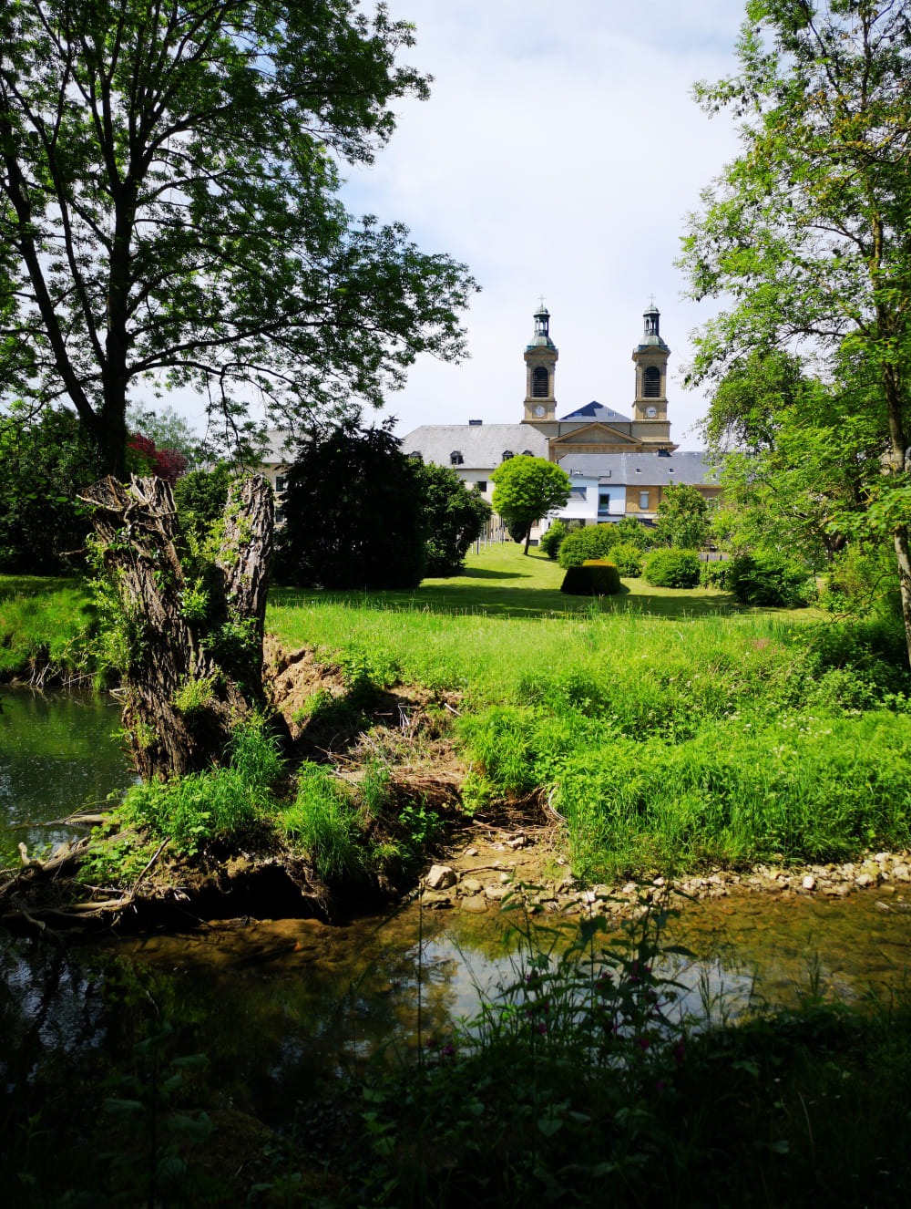
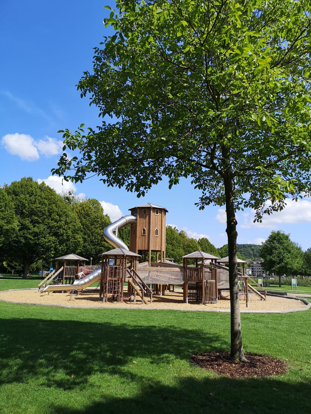
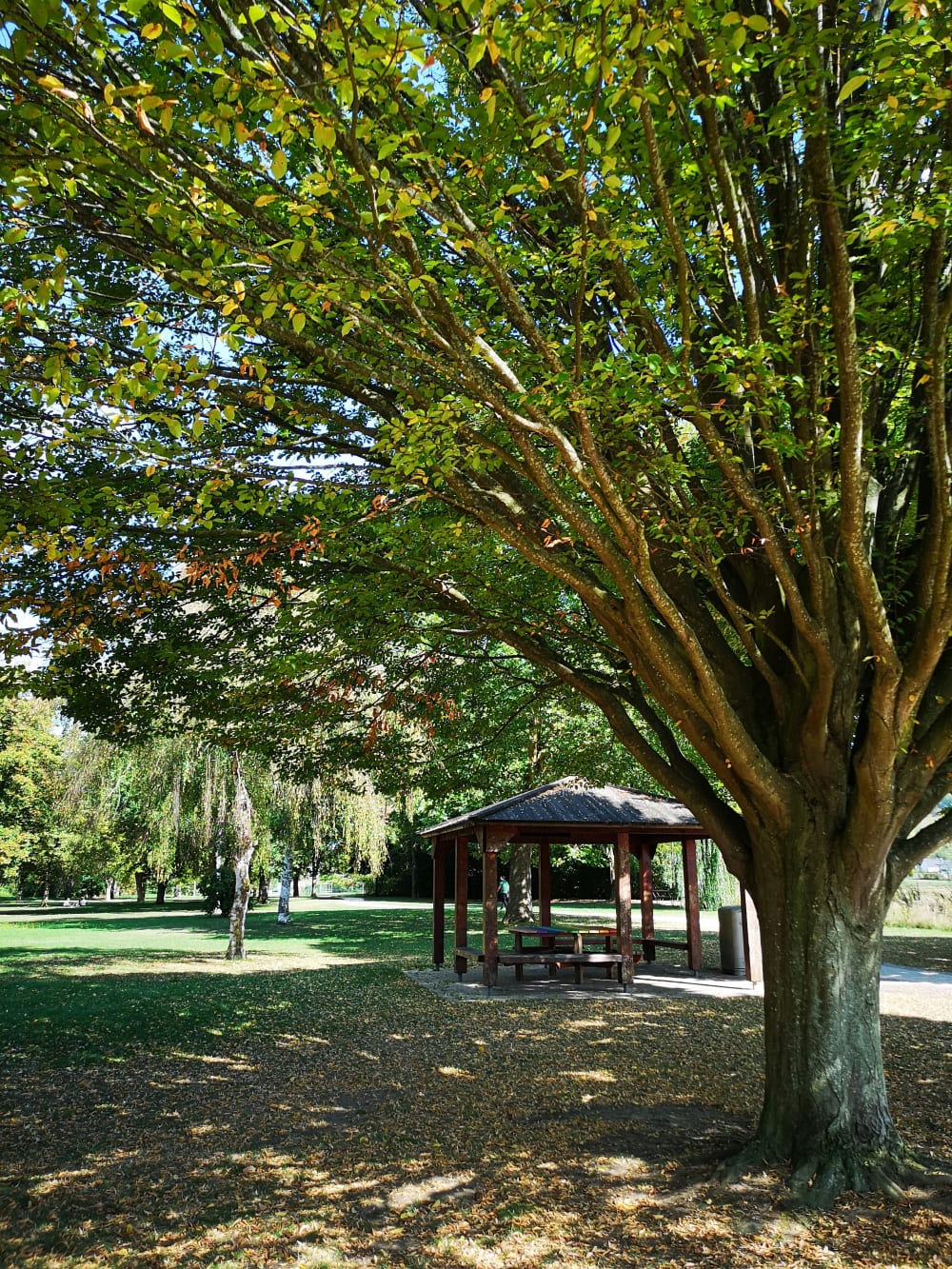
THE PARK IN MERSCH
Mersch is well-known through its unique park. At the beginning, the park had a surface of 3.2 hectares. As of 1997 – 2000 the park expanded its surface to 9 hectares and nowadays, its surface takes up to (covers) 13 hectares. In the flood plain, a small artificial lake came into being. A very interesting playground was created for the children and the youth can enjoy themselves on different creative attractions.
In the direction of Rolling this public garden is connected with the farming fields and consequently creates a fluid transition of the artificial created public garden with the farms of the community of Mersch.
RAILWAY STATION MERSCH
On 21 of July 1862 the first railway section Luxembourg – Ettelbrück was festively inaugurated. The station building of Mersch was also finished in time.
In 1876 the building was enlarged and became a significant identification mark thanks to the extension of the Tower. Since 1989 this train line is electrified.
The railway attracted many small industries and shops, so that Mersch grew beyond the old Udingen towards the station. In 1868, the Servais family founded the Mersch sugar factory opposite the station. From 1954, the Mersch Agrocenter developed its operations on a 33-hectare site. The Agrocenter is now closed and will give way to the “Quartier de l’Alzette” residential area.
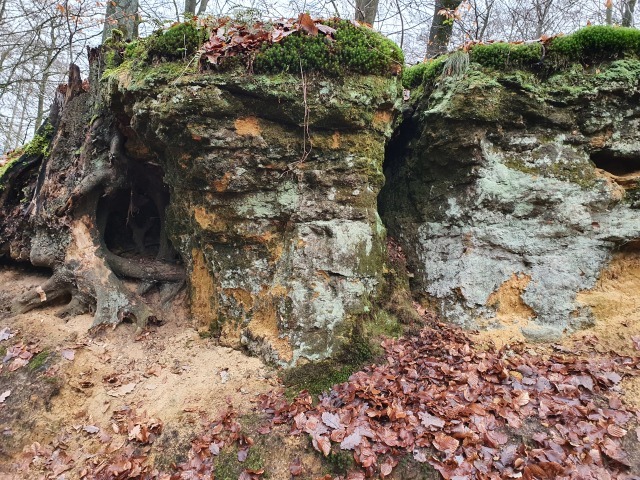
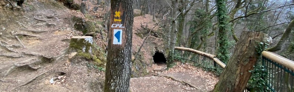
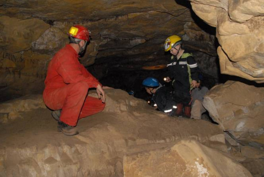
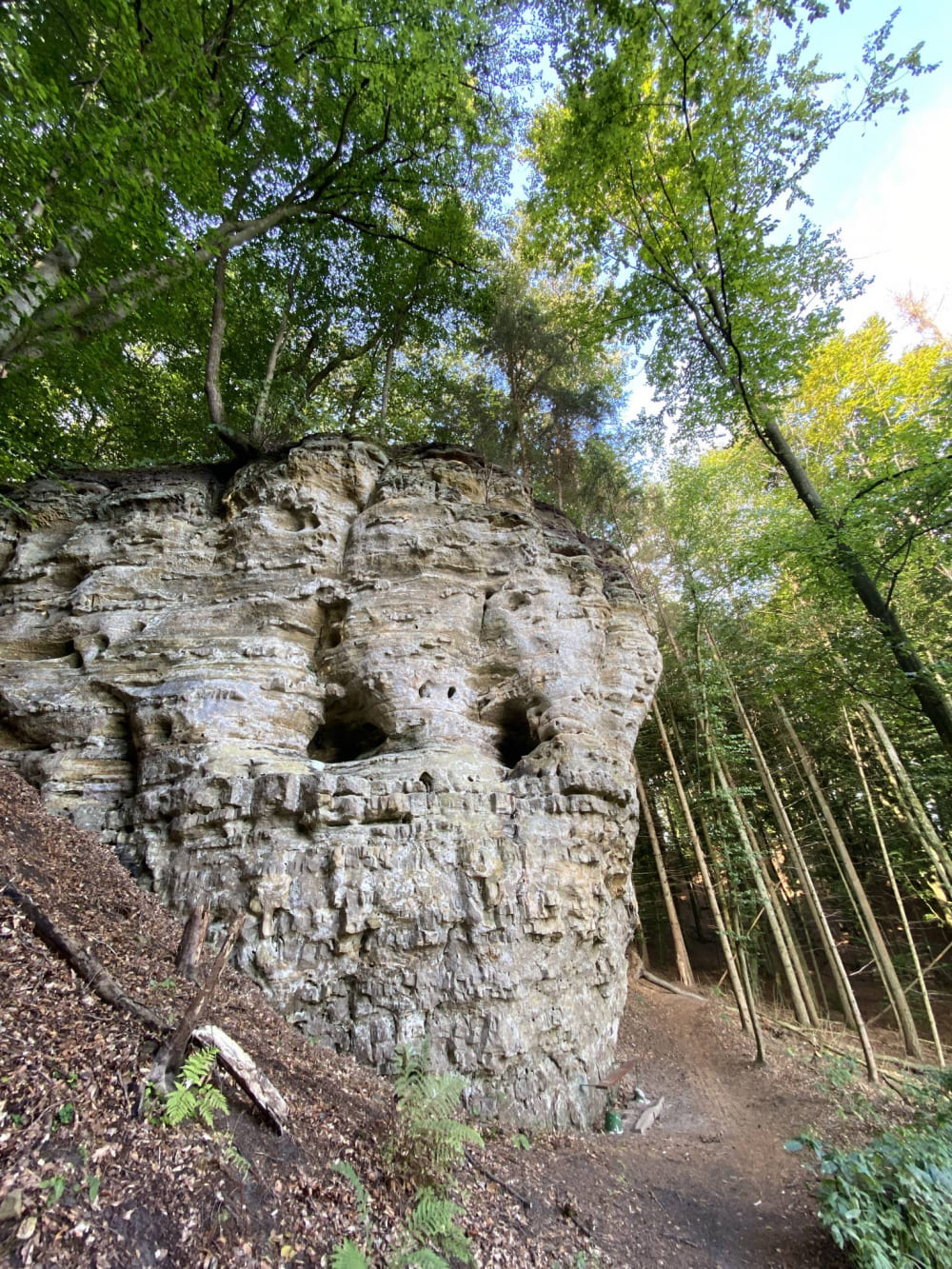
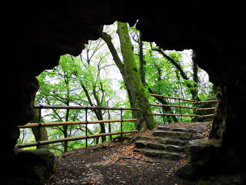
MAMERLEEËN
The caves to the North of the Schoenfels-forest are very popular and provide an adventurous experience. This subterranean labyrinth of tunnels, corridors and mountain cleaves, is a quarry created by human beings. The total length of these accessible, subterranean tunnels is about 1000 meters. As we don’t have any historical sources, you can develop your own theory.
Geology gives us an answer to the question, why our grandparents did this tough and heavy work to dig these tunnels: a combination of different kinds of sandstone, which were located some meters below the surface. Some sandstone was very hard and massive. In order to get these stones, people were obliged to dig tunnels into this mountain.
- Open from May till September.
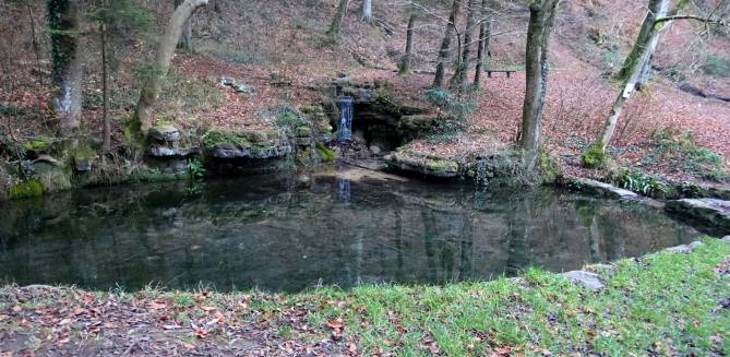
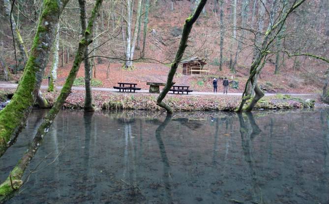
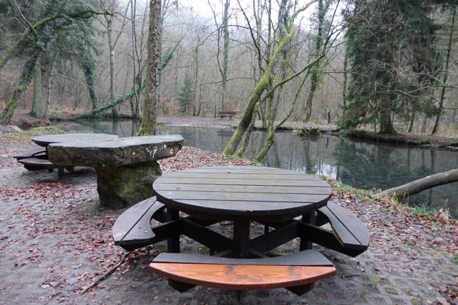
THE HUNNEBOUR
On the west side of the Hardt a well rises between the rocks. This source builds a small pool and flows into the Eisch river; we find ourselves at the “Hunnebour”. With the “Hunnebour” a series of legends are connected to this place. Memories of the “Hunnen”-population come into our minds. Healing powers are attributed to its water.
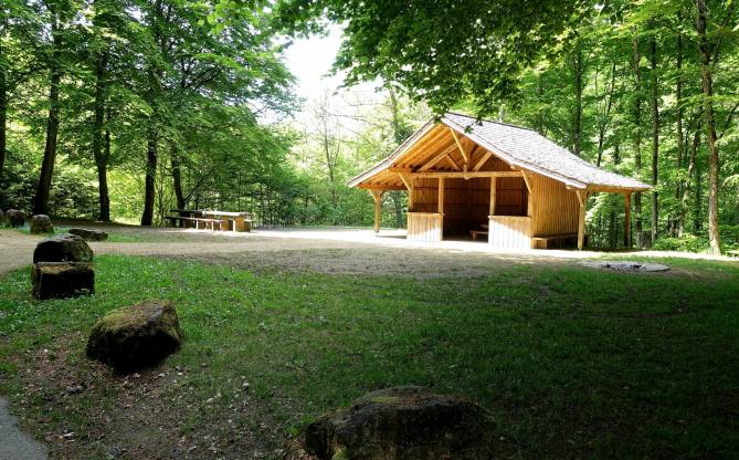
At the beginning of the 20th century, an association created a cottage to organise festivities here in the forest. In his book “Im Werden und Wachsen”, Nicolas Welter disapproved this intervention in the nature. However, those festivities are not really a success. Rubbish of food, bottles and more is left behind.
DREIBOUREN
In the Rollingen forest, three small springs gush out of the rock next to each other: the “Dreibouren”. Their water flows over a small waterfall into a larger pond. The site was created on the initiative of Ernest Faber, the former president of the Mersch Tourist Office. A stone in his honour was installed in 1958.
In the neighbourhood of this “Dreibouren” we find an old pilgrim’s place in honour of “Mater Dolorosa”, the “Rollinger Bildchen”. In 1948 a “Lourdes-Cave” was inaugurated. Every 2nd Sunday in September a “Bildchen” procession is organised by the “Friends of Rollinger Bildchen”.
REMARKABLE TREES
The “Beringen Oak”. This oak, which stands on a rock known as ‘Kuckelee’, is considered to be a natural bonsai tree. It’s almost a miracle that its roots have found enough nutrients to grow so slowly. As far back as 1907, forestry inspector Mr Faber described this oak tree.
The “*High Beech of Rollingen” was described by Mr. Faber. In the forest named “Alheck*, this beech, with a height of 40 meters, rises above everting else. On breast height, the straight trunk has a diameter of 97 cm.
In the garden of the “Center National de Literature” of the Servais house stands a tremendous “Copper Beech”, this Beech can be more that 150 years old.
THE GEOGRAPHICAL CENTER OF THE COUNTRY
The Geographical Centre of the country is located to the north-west of Pettingen, in the “Pëttenerbesch” nature reserve.
In 2011, this place has been marked with 4 triangular steel plates, which show the 4 compass directions. On one of those steel plates 49°46’38” N 06°05’43”O is engraved.
The Geographical Centre has been calculated by specialists from the Land Registry. The topographical calculation is based on the World Geodetic System 1984 (WGS84).
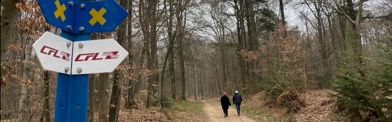
WAY CROSSES / WEEKRÄIZER
The Celts and Romans had already placed their fields, houses and courtyards under the protection of their gods. Christianity has retained this piety. Roadside crosses generally express petrified memories of blows of fate. In 1989, the “Weekräizergrupp”, a group led by Ferdy Fischer, the parish priest at the time, was set up to save the wayside crosses from decay.
Photos copyright ORTCO, www.visitguttland.lu & www.visitluxembourg.com
DISCOVER OUR REGION
To make the most out of your stay in this beautiful region, here are some of our suggestions: